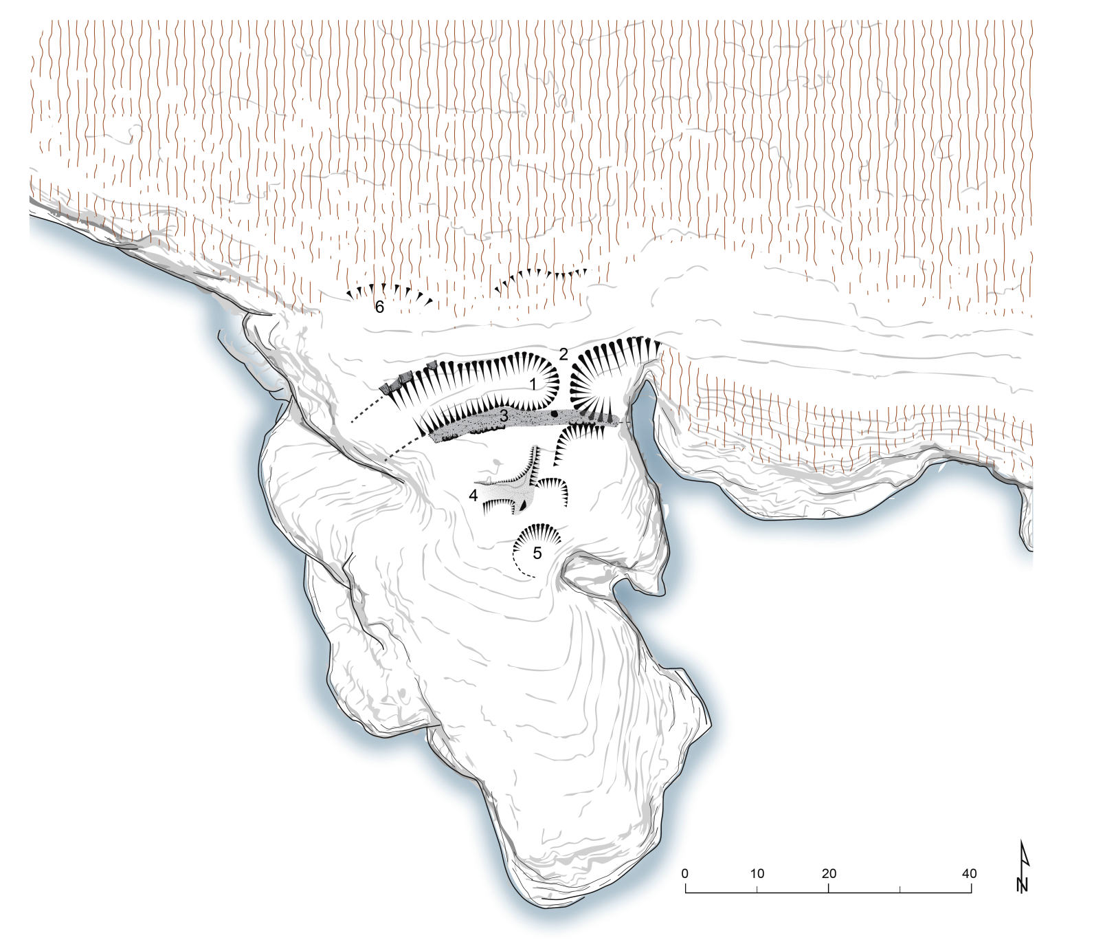
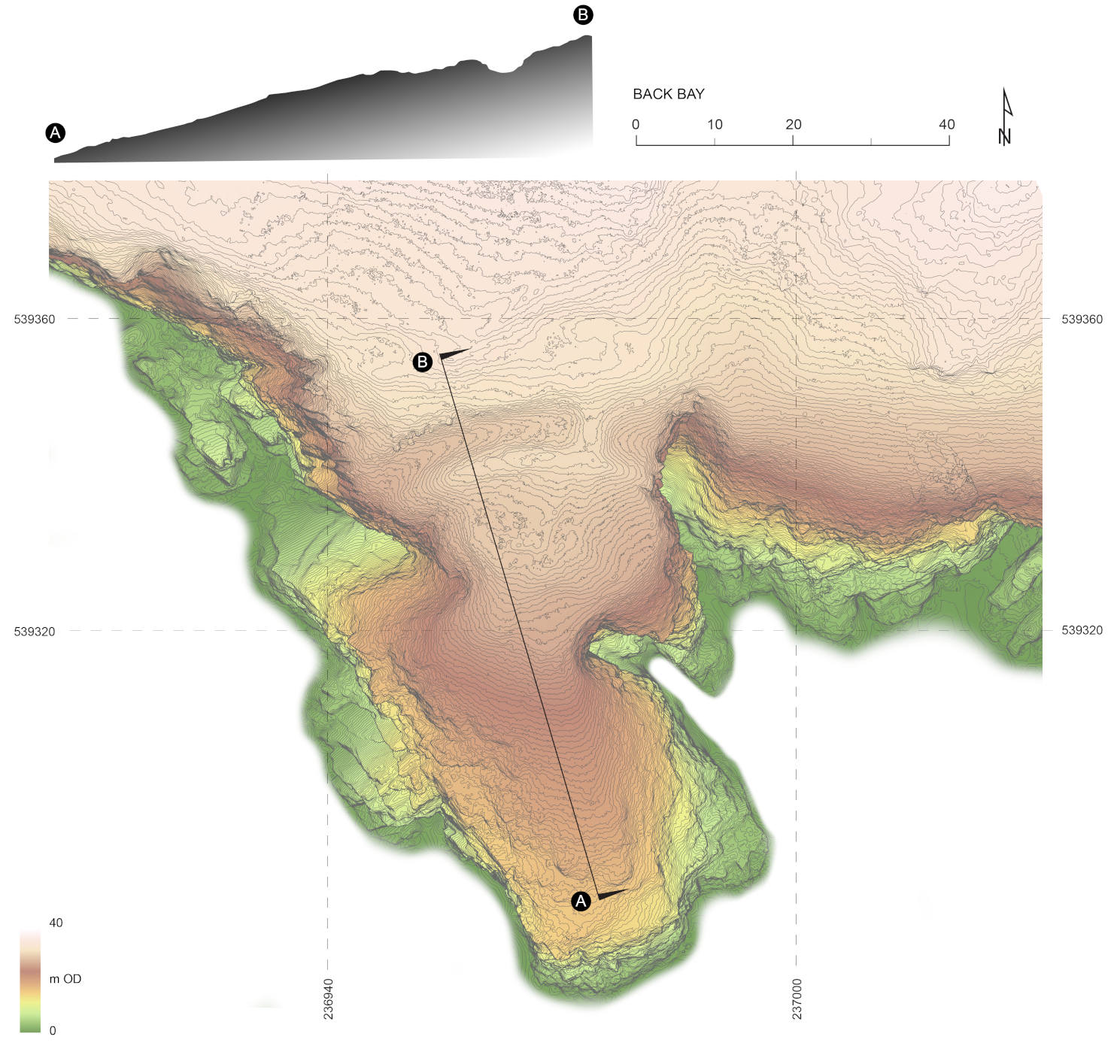
Participants in the Whithorn-MAP project carried out a new survey of the Iron Age fortification at Back Bay, near Monreith, in 2025. Back Bay is one of the most spectacular examples of an Iron Age promontory for in the Machars, with ditches almost 2m deep defended by a stone rampart. Traces of stone buildings in the interior may represent later activity in the medieval or post-medieval centuries.
Project trainees learned techniques of manual measured survey using tapes and plane tables, as well as 21st century approaches including using robotic total stations (a modern theodolite) and GPS, to produce a new record of the fort and its current condition.
Supported by: