
Excavations at Sinniness: An Iron Age loch-side settlement?
An update on the first block of fieldwork for Whithorn-MAP: a prehistoric settlement in the north-west Machars
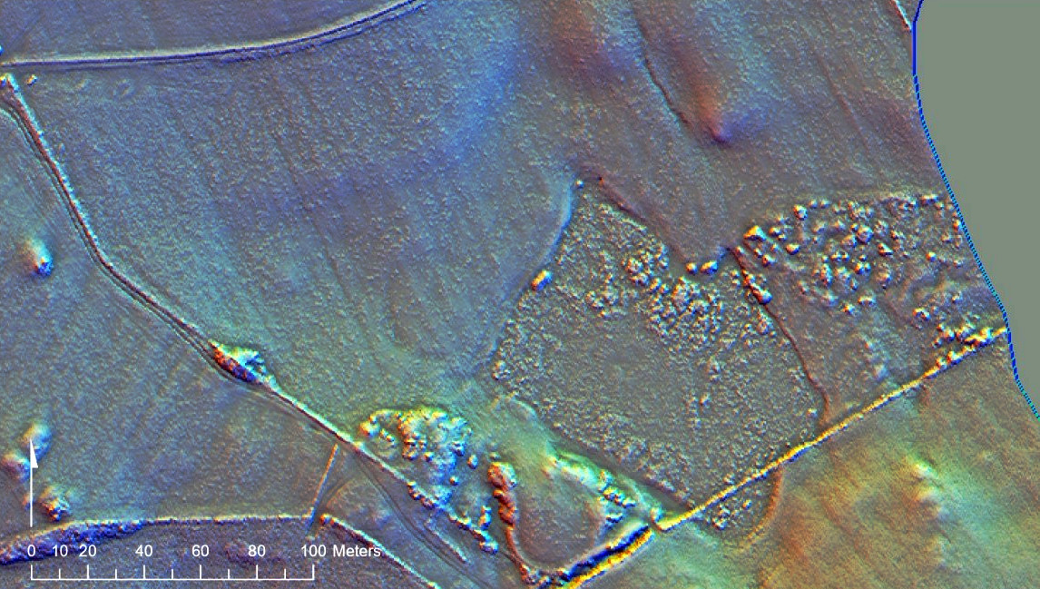
In 2025, the Whithorn Trust completed exploratory excavations at a newly-discovered archaeological site at Laigh Sinniness, in the north-west of the Machars. The site had come to light through our Machars Waterborne project, where volunteers had sifted through aerial laser scan data (known as LiDAR) for traces of unrecorded archaeology.
You can read more about the Machars Waterborne and download the report here.
One of the sites identified in that project was on farmland at Laigh Sinniness, where a dark circle in a field to the north of the drained Sinniness loch looked likely to indicate the presence of a prehistoric settlement.
Working with a team from AOC Archaeology Group, we began our investigations at Sinniness with exploratory sediment coring: using two transects we cored across the site, recording the soil profile and the presence of stone, which it quickly became obvious that there was a lot of!
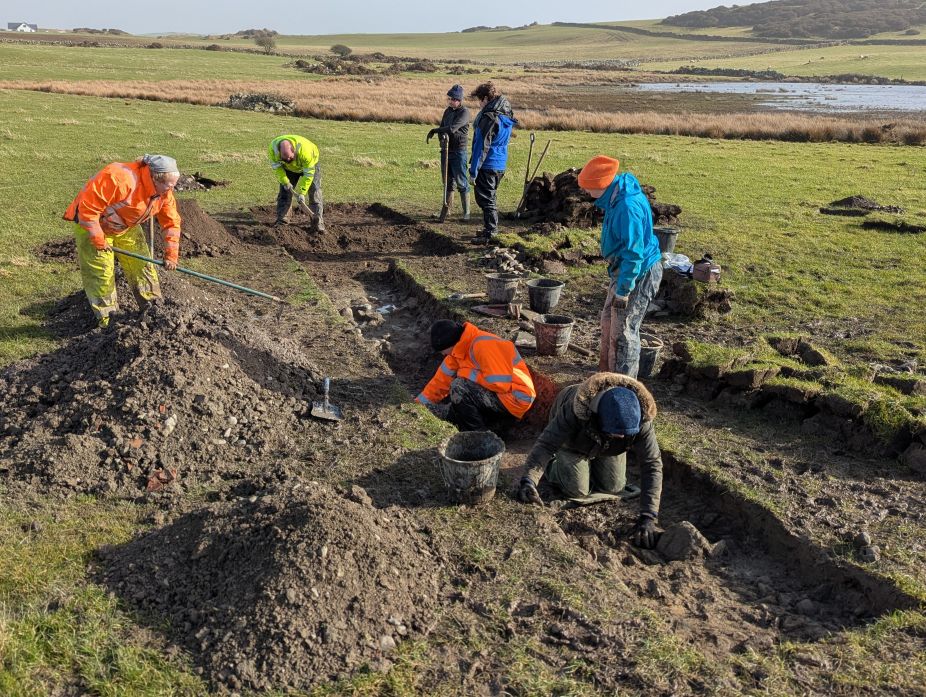
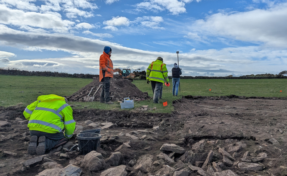
Our next steps were to excavate some exploratory test pits, each of which found a stony layer beneath the turf. A larger trench was opened up over the position of the possible ditch, confirming that our site was indeed encircled by a ditch around 1m deep- a common feature of late prehistoric settlements.
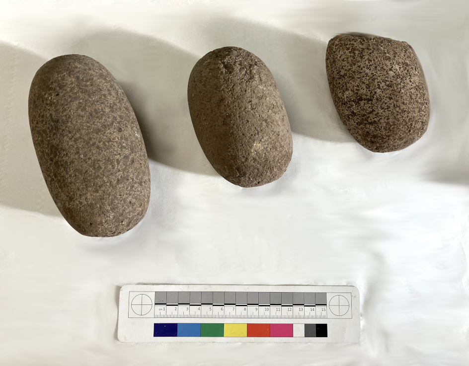
Our second week of excavation opened two larger trenches in the interior of the site. These found extensive stony spreads underneath a peaty occupation deposit. The stone was very mixed and did not form any obvious patterns, looking more like it had been laid down as a foundation platform for a dry surface. Excavating the peaty deposit, we found evidence of activity in the form of cobble tools: hammer stones, pounders and rubbers made from rounded beach cobbles, as well as a nice whetstone, used for sharpening metal blades. Stone tools like these were used throughout prehistory, and are a common find on bronze and iron age settlements.
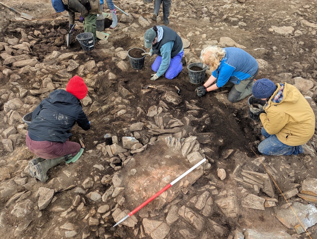
Conclusive evidence for occupation came in the form of a clay hearth base, formed from clay packed onto the stones that formed the foundation platform. The clay had been baked and was surrounded by a charcoal-rich soil, indicating that it had been used as a fireplace. We collected samples from the hearth for radiocarbon dating, which will hopefully provide the most direct evidence for the date of this activity.
Further exploration confirmed that the ditch circled the occupation area. In our second trench it was well over 1m deep, and at the base contained fragments of bone and charcoal. We collected samples from all of these soils, which will be analysed back in the lab for further evidence of the plants and animals that might have been around when the settlement was occupied.
So, what is it?
Our excavations showed that the Sinniness site is indeed a settlement: hearths and stone tools typical of domestic activity are good evidence that people lived there at some point. At the moment, we don’t have a reliable indication of when this might have happened, but the absence of pottery (common in the Bronze Age, but generally absent in the Wigtownshire Iron Age) might suggest that our site is Iron Age in date.
What next?
The location of the site, at the edge of the loch and probably in very wet or marshy ground before the loch was drained means that the surrounding ditch might well have been water-filled, at least some of the time, and this draws parallels with the many crannogs (settlements built on artificial islands) and similar sites, like Black Loch of Myrton, that were in use in the earlier Iron Age in South West Scotland.
Our finds and samples will be analysed by specialists in an archaeological laboratory, and we will submit samples for radiocarbon dating, hopefully providing a reliable date for the activity at Sinniness. The contents of the soil samples might provide further evidence for activities on site relating to farming and subsistence, for example in the form of cereal grains that might have been cultivated by the occupants.
Stay tuned for updates on the results from Sinniness, which we will post here!
Supported by:

Partners:
