Our LiDAR analysis project is off to a great start: project volunteers have identified over 300 new possible archaeological sites in the NW area of the Machars alone! This week, we met online to review some of the highlights and discuss the identifying characteristics of prehistoric archaeology in our study area.
A selection of newly identified prehistoric sites in the coastal zone are shown below, along with our initial thoughts on their significance.
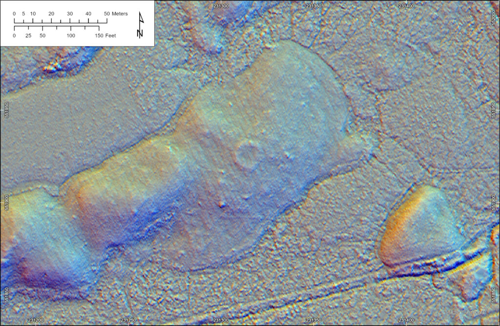
An example of an unrecorded hut-circle in an area of grazing
Hut circles
Some of the most frequently-spotted prehistoric settlements in the LiDAR dataset are circular banks referred to as ‘hut-circles’ by archaeologists. These first began to be built in western Scotland in the late Neolithic, but most examples date to the Bronze and Iron Ages, so in the last 2000 years BC. This is a great example: a classic ring-shaped bank in an area of semi-improved grazing.
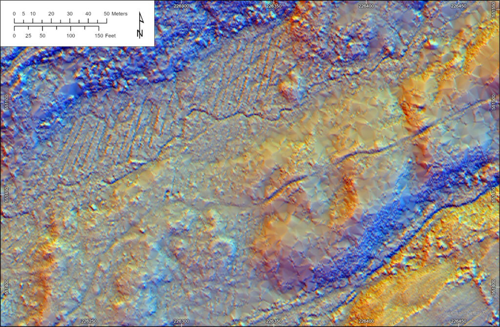
A probable hut circle and burnt mound in forestry
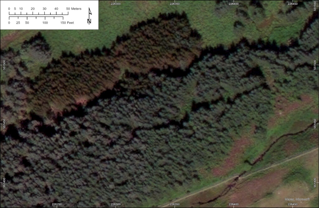
The same area as the previous image, showing the sites in conifer forestry
Some identifications came from areas now managed as forestry: the images above show the same area. In the top image, the LiDAR has seen through the trees to the bare earth below, and shows the remains of another probable hut circle and, on the north side of the stream in the upper part of the image, a possible burnt mound (visible as a ‘kidney bean-shaped lump). Burnt mounds are the by-product of heating stones in fire to heat water- their precise purpose is not known but they may have been associated with bathing or even as saunas. Most examples in Scotland date to the bronze age, typically between 1500 and 800 BC.
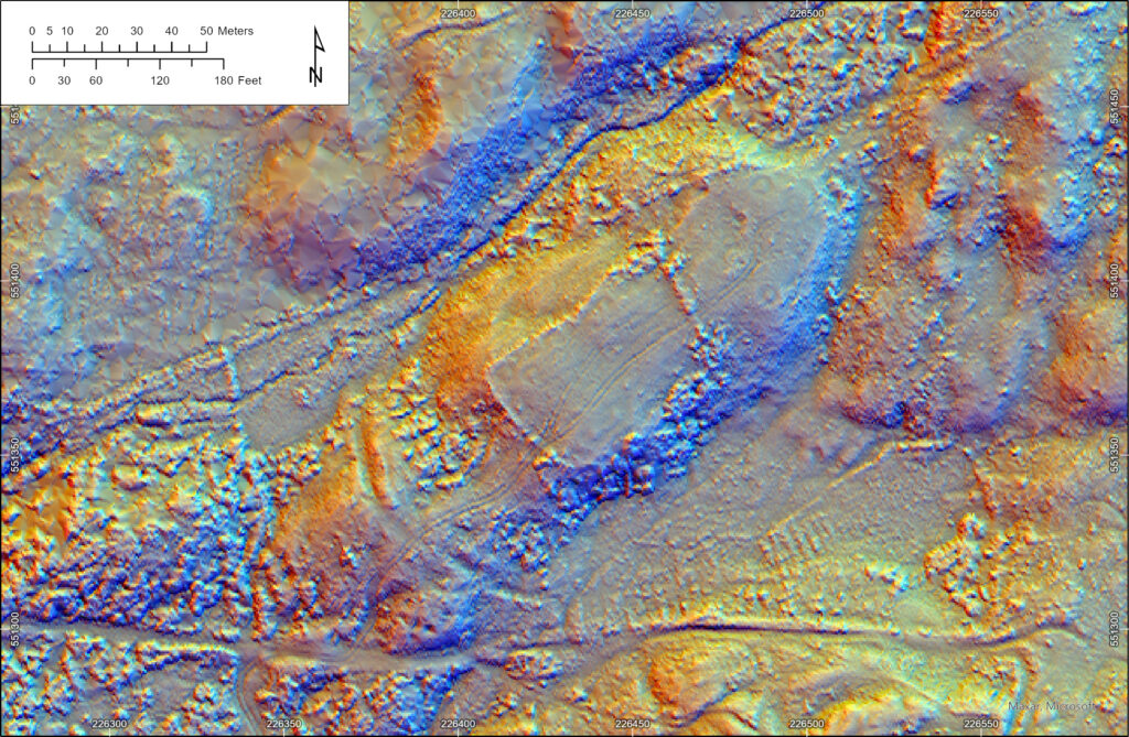
The curving ditch cutting off this ridge may be the remains of an Iron Age fort
Close to the hut circles above, this raised ridge of land seems to be cut of by a deep curving ditch. Later agricultural remains are visible in the interior, including a rectangular enclosure and some circular scrapes caused by cattle feeder bins, but this earthwork might indicate the presence of a fort. If this is correct, it was likely built in the earlier Iron Age, between 500 and 0 BC.
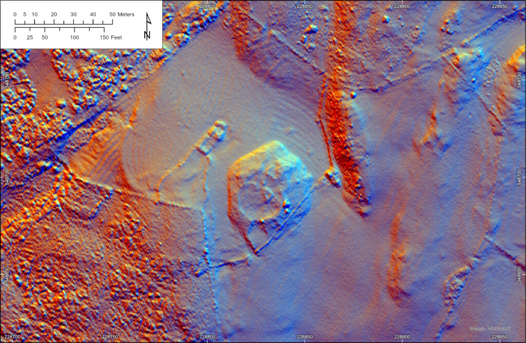
A possible new Iron Age settlement, close to a later farmstead building
LiDAR can help us identify features that previously evaded detection. In this image, one of our volunteers spotted the large circular lump to the south-east of the later farmstead. It is very likely that this mound is the remains of a large stone settlement. Several others in the area are known and excavations have been carried out at two. Although they are undated, they were probably in use in the middle Iron Age, in the late centuries BC or early centuries AD. They are a very distinctive group of monuments found on the Machars west coast.
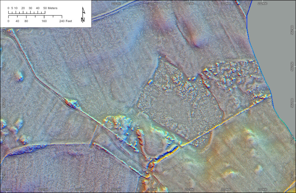
The site of a possible ‘crannog’ at Loch Sinniness
This site was well spotted by one of our volunteers. This is the partially-drained remains of Loch Sinniness. A possible crannog was noted here in the 19th century, but no evidence of it has been observed since; in this LiDAR image, a circular ditch in the wet ground, formerly part of the loch, is visible. It is likely that this is the site of the ‘crannog’, although in this case the settlement may have been surrounded by a ditch to create a moat-like enclosure in marshy ground.
The site is marked on the Ordnance Survey’s 1st edition 6-inch to the mile map.
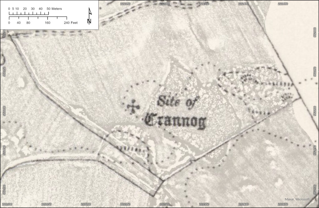
The position of the Loch Sinniness ‘crannog’ on the OS 1st edition map